Published June 7, 2017
By Mark Henderson
Special to ULM Office of Public Information
The untrained eye sees a pebble, about the size of a pea.
The trained eye sees in the pea-sized particle a piece of pottery, a tiny part of
an intricate puzzle.
Dr. Diana Greenlee, Poverty Pointstation archaeologist and University of Louisiana
Monroe adjunct professor, has been working to put the pieces together since coming
to ULM in 2006. Greenlee studied anthropology at the University of Washington and
inquired about the ULM position on the advice of her graduate school adviser who retired
and moved to Natchez, Mississippi.
The Poverty Point World Heritage Site is an archaeologist’s dream laboratory. The
state park just outside Epps in West Carroll Parish was home to a sophisticated Native
American Indian culture about 3,400 years ago. The site is known for enormous earthen
mounds and ridges, and a large, flat plaza. The earthworks are unique in design.
Research indicates the Indians who built the mounds did not raise crops but relied
on hunting, fishing and gathering wild nuts and fruits.
She believes the Poverty Point builders decided on the spot on the eastern edge of
the Macon Ridge, which marks the western terminus of the Mississippi River plain,
because “this setting is what we call an ecotone,” the cusp of two ecosystems. Both
spearheads and fish hooks have been discovered on the grounds.
The ridge is the beginning of an upland, providing safety from flooding. Mississippi
floodwaters never covered Poverty Point. The uplands also provided deer and wild foods
the dwellers could forage.
But below Macon Ridge is the Mississippi River plain. It provided fish and other swamp-based
foods.
The Mississippi River provided one more essential thing for Poverty Point. Trade.
More than 78 tons of stone and ore were imported to the site from distances up to
1,000 miles away.
Much is known about Poverty Point. Even more is not. The land teases scientists with
its mysteries. New research at Poverty Point is looking beyond the traditional boundaries
of the World Heritage Site in hopes of revealing clues to the biggest mystery of all.
“The one big question,” Greenlee said, “is what happened at the end. Did they just
go away? Maybe they depleted their resources. Or did they disperse into smaller groups?
We don’t know.”
The answers come slowly and through a process of elimination.
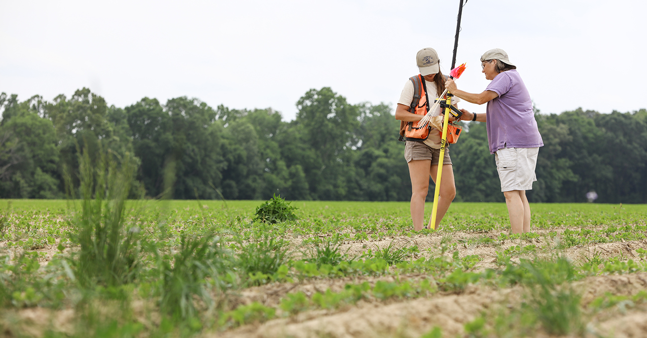
Archaeologist Alisha Marcum of Nashville, Tenn., left, and Dr. Diana Greenlee, center,
Poverty Point station archaeologist, record the GPS coordinates of an artifact found
in a field close to Poverty Point World Heritage Site. This summer, researchers are
combing more than 19,000 acres surrounding the site to gather more information about
the ancient builders and visitors to the mounds and earthworks in West Carroll Parish.
Emerald McIntyre/ULM Photo Services
“We don’t know why they built the mounds,” for instance, Greenlee said. “We probably
won’t ever know. But we know, through research, that they are not burial mounds and
they weren’t platforms for buildings.”
Field research is more about eliminating hypotheses than discovering a holy grail.
The state of Louisiana owns and manages Poverty Point. It was added to the UNESCO
World Heritage List in June 2014. Poverty Point is also a National Historic Landmark
and a National Monument. It is the largest, most complex archaeological site of its
age in North America.
The original site plan had five mounds, six concentric C-shaped earthen ridges and
a large, flat plaza. A sixth mound was added about 1,700 to 2,000 years later.
Historically, research at Poverty Point concentrated within the confines of the park.
In February, ULM entered into a cooperative endeavor agreement with the Louisiana
Department of Culture, Recreation and Tourism providing for $148,300 in funding for
an archaeological investigation of the landscape around the Poverty Point World Heritage
Site. Greenlee said the impetus for the project rose from the World Heritage process.
Researchers are fanning out to explore 19,422 acres in West Carroll and East Carroll
parishes within a radius of about 5 kilometers from Poverty Point. The 5-kilometer
radius is regularly used in archaeology as a common boundary for daily foraging among
hunter-gatherers in a resource-rich environment.
Greenlee has been able to hire two archaeologists to work on the project, operate
field schools and to purchase equipment. On this day, 14 students and a faculty member
from Mississippi State University were cleaning samples in water and cataloging their
findings.
The property being explored is privately owned. Most of it is prime farmland. The
tilling, planting and harvesting have taken their toll over the years. Greenlee says
there’s no way of knowing what has been lost.
“You work with what you find,” she said.
With permission of the landowners, the researchers - professionals and students -
head out to the fields.
“When we walk the fields, we look for artifacts. We flag each artifact and come back
with GPS to log the location,” Greenlee said.
In areas where surface visibility is limited, shovels are used to scoop shallow samples.
Among the content in the recent scoops of samples have been siding from an old home,
some rubber but also slivers from tools and pieces of pottery.
The wet spring has slowed the gathering of artifacts, but the work will soon shift
into high gear. In June, Greenlee is hosting ULM field schools. Students are also
coming from the University of Southern Alabama and Binghamton University in New York.
More than 30 students will take residence at the Poverty Point field school dormitory,
which can house up to 40.
Greenlee knows better than to expect a huge revelation. She’s eager, though, to see
what the land will offer up.
“The idea is to enhance the experience of the visitor by being able to tell a fuller
story,” she said.
After the field work is done, Greenlee will supervise the building of a database of
the researchers’ findings in order to map the distribution of tools and pottery and
put them in the context of how the land was used then and now.
“We are interested not only in how the people who built the Poverty Point earthworks
used the landscape, but also how earlier and later people used the area,” Greenlee
said. “We assume that there is a continuous distribution of artifacts across the landscape
and that variation in the density and characteristics of artifacts corresponds to
different use histories of the land. By documenting the spatial patterning of artifacts,
we hope to understand the full range of landscape use through time.”
Dr. Jeffrey Alvey, the Mississippi State University faculty member working with the
students on site, said his students are getting valuable experience learning how to
do archaeological surveys. In return, he said, the students are helping Greenlee to
determine how far the people of Poverty Point roamed, what they did out there and
whether “there were any outlying contemporary communities outside the core Poverty
Point site that supported it,” similar to ancient suburbs.
Dean Nones, one of the archaeologist hired for the program and a Pittsburgh native,
said working on the project has provided the opportunity to further develop his skills
and apply his knowledge. He knew he wanted to do this work since he was 2 and his
parents took him to see “Indiana Jones and the Temple of Doom” at a drive-in.
And while Nones hasn’t had to run away from rolling boulders, he did have to high-tail
it away from a mother black bear whose cub was in a tree near where he was working
since working on the project.
The project has depended on the willingness of landowners to have strangers walk through
their crops. Some have requested the teams wait until the crops are harvested, but
no one has refused.
“The response from the landowners has been terrific,” Nones said.
The property owners are told that any artifacts found on their land will be returned
if they wish after they have been properly entered into the database. They also have
a standing invitation to participate in the research occurring on their land. The
landowners, mostly farmers, also have the option to donate the artifacts to Poverty
Point.
If donated, the artifacts will be boxed and added to the those collected over the
years. The collection is stored at Poverty Point and managed by Alisha Wright, collections
manager for the past 19 years.
Greenlee said the landowners will be told when artifacts are discovered.
“My hope is that they might want to learn how they can protect the area where there
was a finding,” for instance when building sheds or making other improvements to their
property.
“It’s interesting to learn how invested people are in their landscape,” said Alisha
Marcum of Nashville, the other archaeologist hired to work on the project.
Marcum is looking at how today’s property owners are using the land as compared to
the past, but she notes the strong attachment to the land endures.
“It’s the same today as back then,” Marcum said.
Some 3,400 years ago, a people populating northeastern Louisiana along Macon Ridge
excavated soil in what research indicates were 50-pound basket loads. About 15.5 million
of these loads were moved to construct Mound A at Poverty Point, the second largest
Indian mound in the United States. No one knows why.
Today, scientists are digging in the ground around Poverty Point again. This time
with small shovels and augers, hoping to find answers to questions the ancient civilization
left in its wake.
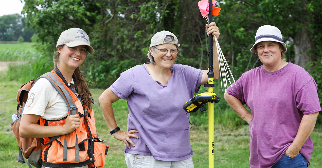
Dr. Diana Greenlee, center, Poverty Point station archaeologist and ULM adjunct professor,
is joined by archaeologist Alisha Marcum of Nashville, Tenn., left, and Alisha Wright,
Poverty Point collections manager, right, after checking a field near Poverty Point
where several new finds were marked by GPS and collected for research.
Emerald McIntyre/ULM Photo Services


